
Transit · Chart
SkyTrain runs out to the southeast; Canada Line runs N–S
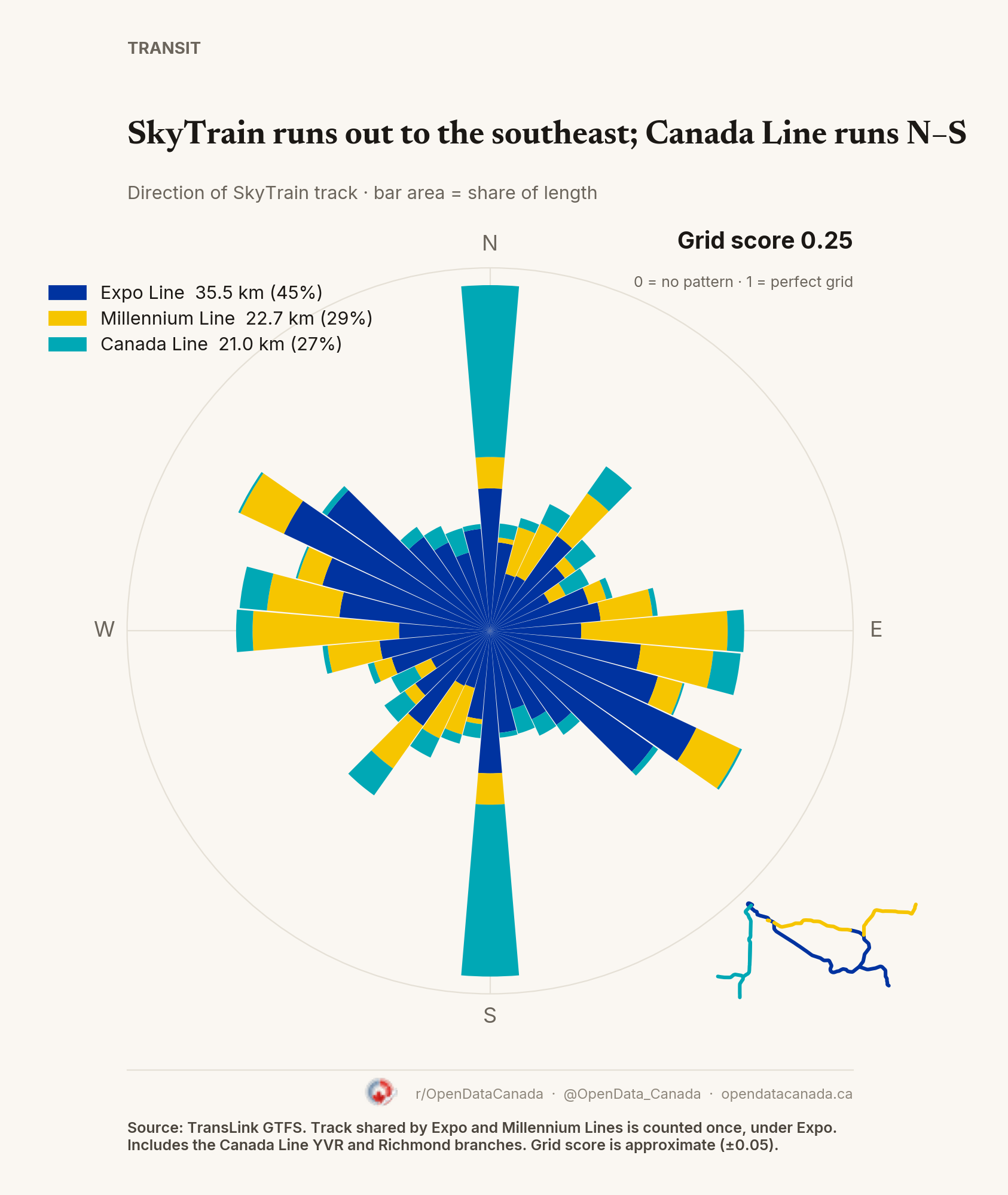
Vancouver's three SkyTrain lines score 0.25 on a 0–1 grid scale. The Expo Line heads southeast to Surrey, the Millennium Line runs mostly east–west, and the Canada Line runs close to due north–south.
What the chart shows
Each bar is a compass direction; its area is the share of track running that way, coloured by line. A north–south track counts for both north and south. Grid score (orientation order) is approximate, about ±0.05, depending on where the 10° bins start.
Expo Line (35.5 km), Millennium Line (22.7 km of its own track) and Canada Line (21.0 km, including the YVR and Richmond branches). Track shared by the Expo and Millennium lines is counted once, under Expo. Vancouver has no subway; SkyTrain is elevated or underground on its own track.
Common questions
Is SkyTrain a metro? Yes for this chart. It runs fully on its own track, elevated or underground, with no street crossings.
What is the grid score? A 0–1 measure of how much track points in a few directions. 0 means every direction is equally common; 1 means a perfect grid.