
Transit · Chart
Toronto's subway follows a grid, tilted 17° off north
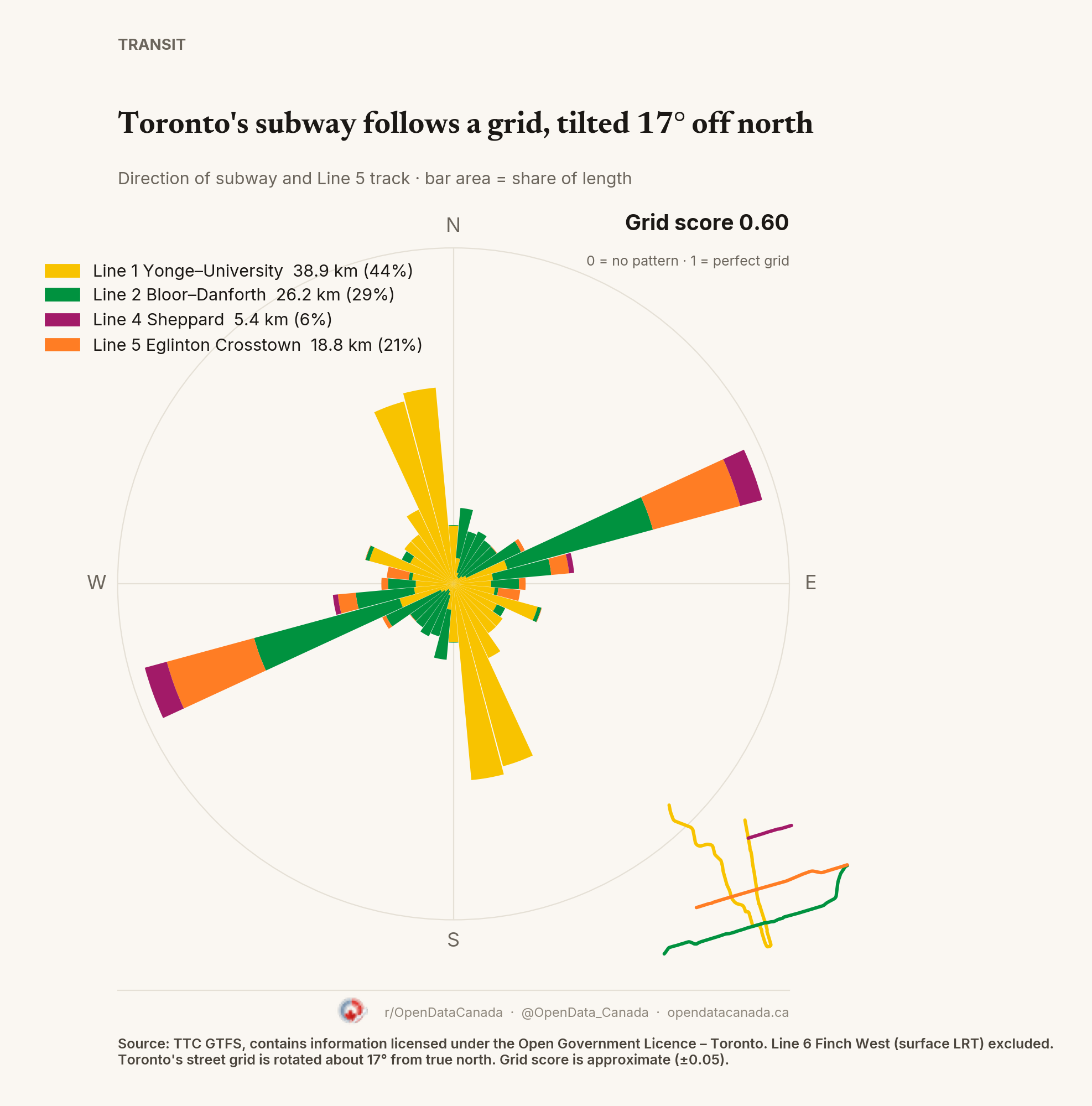
Toronto's subway and Line 5 Crosstown score 0.60 on a 0–1 grid scale, the most grid-like of the three cities. Yonge–University runs almost north–south and Bloor–Danforth and Line 5 almost east–west, all tilted about 17° because Toronto's streets are laid square to the Lake Ontario shore.
What the chart shows
Each bar is a compass direction; its area is the share of track running that way, coloured by line. A north–south track counts for both north and south. Grid score (orientation order) is approximate, about ±0.05, depending on where the 10° bins start.
Line 1 Yonge–University (38.9 km) and Line 2 Bloor–Danforth (26.2 km) make up 73% of the track; Line 5 Eglinton Crosstown adds 18.8 km and Line 4 Sheppard 5.4 km. Line 5 is counted because it runs on its own track, half underground and half in its own street lanes. Without it Toronto scores 0.50. Line 6 Finch West, a surface light-rail line, is excluded.
Common questions
Why is Toronto's subway tilted? Toronto's street grid was laid square to the Lake Ontario shoreline, which sits about 17° off true north. The subway follows the streets above it.
What is the grid score? A 0–1 measure of how much track points in a few directions. 0 means every direction is equally common; 1 means a perfect grid.